Heat Ridge to Bring Back Summer to the U.S.
I think most of us are ready for fall to come and stay for a little while. But if you're in the central and eastern U.S. and thought the summer was behind us, I have some unfortunate news.
The remnants of Typhoon Merbok, a tropical cyclone that developed in the western North Pacific, have already been interacting with the Pacific jet stream. Believe it or not, recurving typhoons can have a profound effect on the downstream weather for a week or more after the event occurs. In this particular case, Merbok entered a region of the jet favorable for its intensification and is currently producing over 50-foot waves in the Bering Sea.
This interaction will cause the jet stream to do what you'd expect a hose to do if you were to grab the end of it and start quickly moving your arm up and down. Notice how much wavier the jet stream will be this upcoming Tuesday compared to this past Tuesday. A wavier jet stream can equate to more extreme weather, on the cold and hot end of the spectrum.
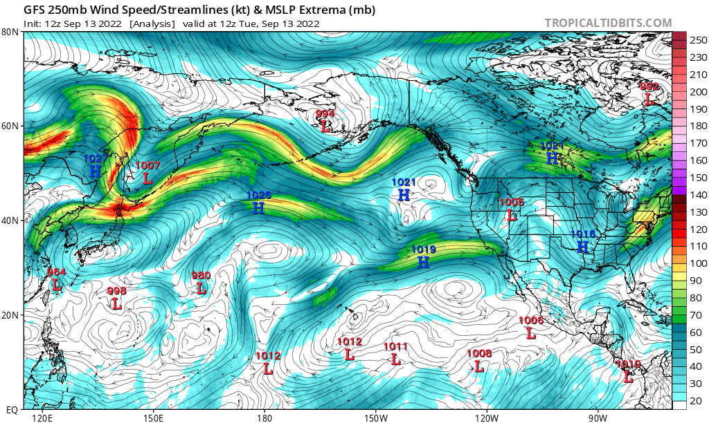
Figure 1: Jet stream analysis for this past Tuesday, Sept., 13, 2022
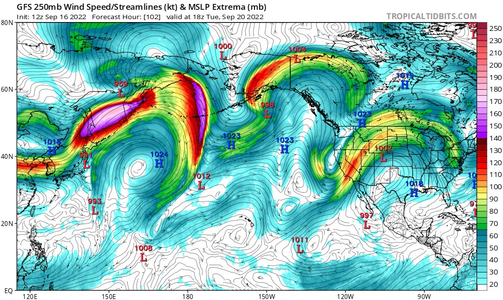
Figure 2: Projected upper-level wind speed and direction for this upcoming Tuesday, Sept., 20, 2022
A trough will dig into the southwestern U.S., bringing below average temperatures there, while a heat ridge will become well-established across the central U.S. by early next week. The good news is that drought-stricken northern and central California may get beneficial rain with this pattern later this weekend and early next week.
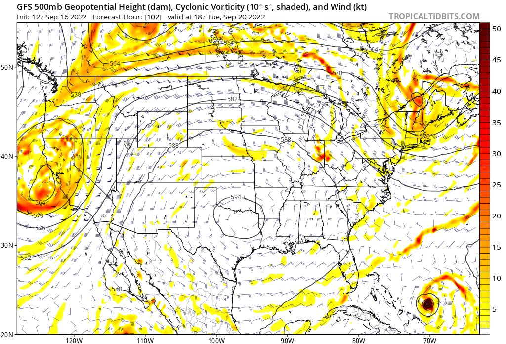
Figured 3: Expansive heat ridge centered over Texas/Oklahoma next week
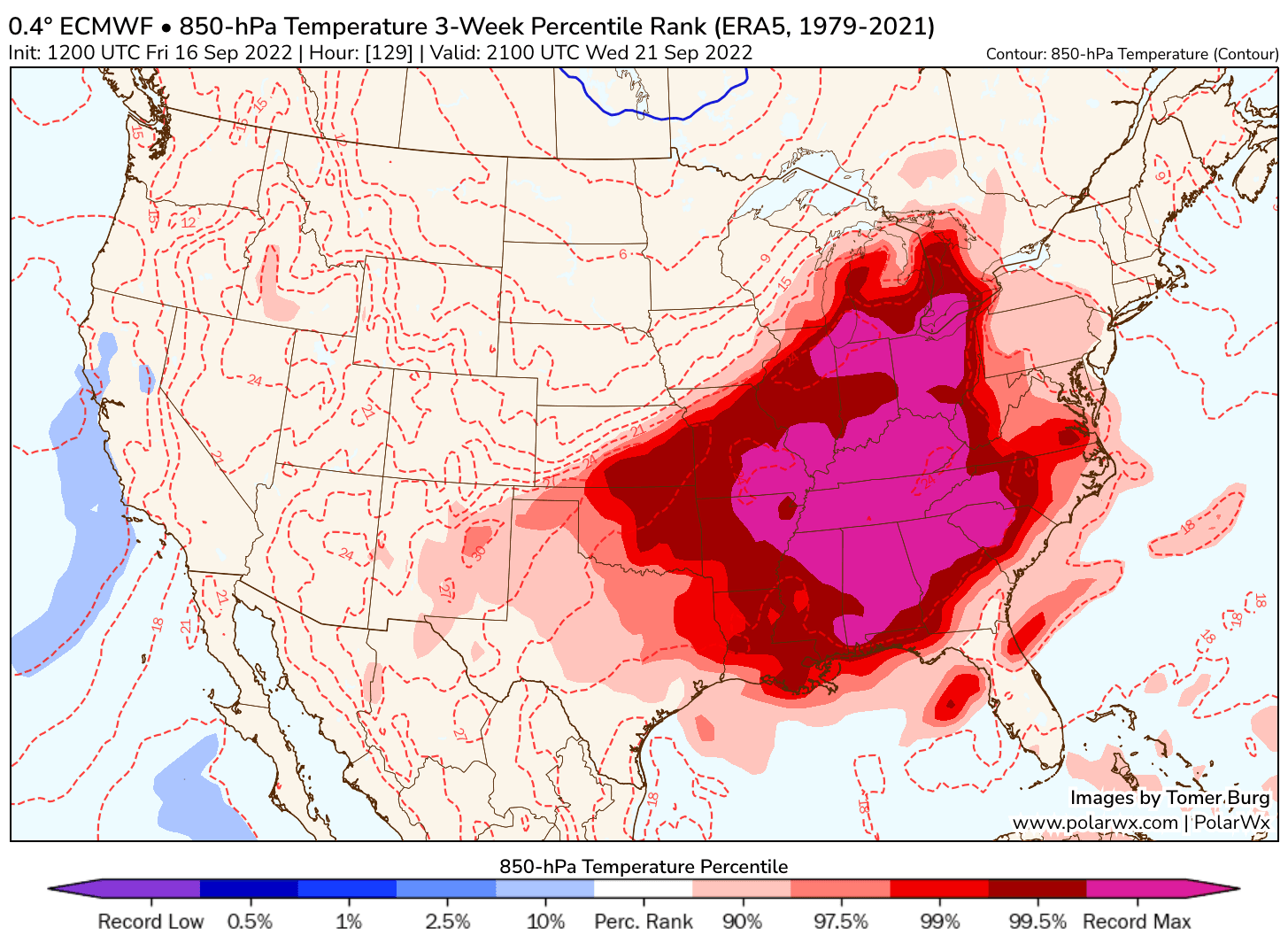
We're not looking at record-breaking cold out West, but the heat ridge will probably bring near or record-level warmth across parts of the central and eastern U.S. We're talking widespread mid to upper 90s across a large swath of the country. Some areas in the South may even approach 100. Luckily, an incoming trough sweeping across Canada later next week will bring a quick end to the hot weather across the Midwest, Great Lakes, and New England. Unfortunately, much of the Southern Plains, Mid-South and Southeast will have to deal with the heat a bit longer.
Hang in there, folks, Make sure you let your family and friends know what to expect next week. Drink water, take care of the elderly, and don't leave pets outside in the heat.