The Major Flooding Risk Doesn’t End with St. Louis
A significant flooding risk will continue across parts of the Ohio Valley and western Mid-Atlantic through much of the week. This flooding threat will slowly slide southward into Tennessee and northern parts of the Southeast later this week into the weekend.
A nearly stationary frontal boundary extends across central Missouri to roughly along the Ohio River into West Virginia. Along and south of this front, above-average moisture in the atmosphere has already contributed to excessive rainfall amounts, particularly along a west-to-east band stretching across St. Louis.
The frontal boundary and embedded shortwaves have provided and will continue to offer sufficient upward motion in the atmosphere. These features will support the development and sustainment of heavy thunderstorms. The nature of this particular setup favors storms developing and training over the same areas for many hours.
Rainfall totals exceeded a foot near and just northwest of St. Louis. In only five hours this morning, over 7 inches of rain fell in St. Louis, making today now the wettest day ever recorded for the city. Such an event is very extreme. But again, the current pattern, unfortunately, will support more flooding this week and weekend. Thus, additional bands of very high rainfall amounts could occur within the broader flooding risk.
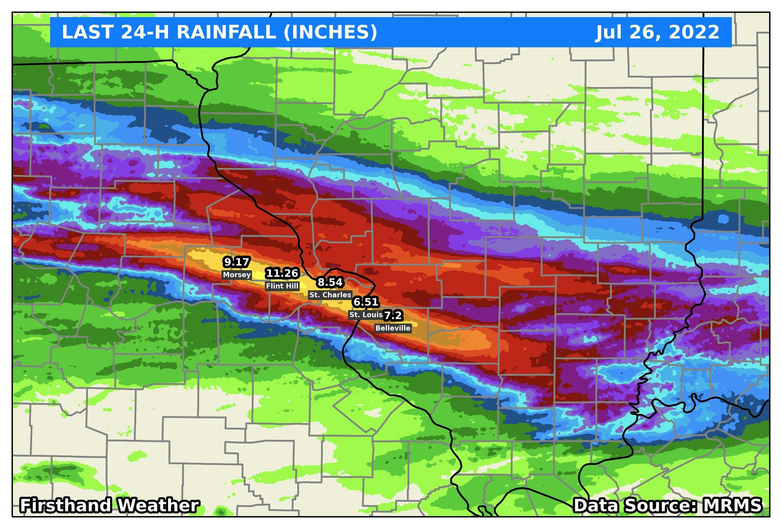
Rainfall totals over the last 24 hours (most of this rain only fell in 6 hours or less!!): July 26, 2022
A storm system currently moving across central Canada will dip southeastward into the Upper Midwest and Great Lakes region this week. This system will feature a cold front that will stall after reaching central Arkansas, Tennessee, and North Carolina. As with the last front, a flooding risk will exist along and south of the front, with the highest risk being a tad farther to the south (more into Tennessee).
The Weather Prediction Center’s latest 7-day rainfall forecast provides a good idea as to where the heaviest totals will most likely fall. If the next frontal boundary stalls a little farther south than currently anticipated, more of the northern Gulf coast states could get in on some higher totals, as well.
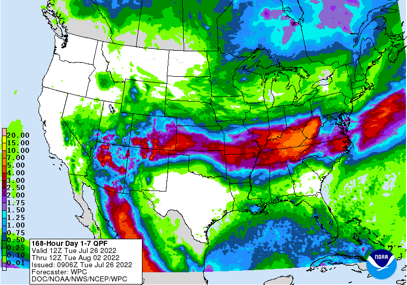
7-Day Rainfall Forecast: July 26-August 2, 2022