Flooding and Severe Weather Risk Incoming
Pattern Overview
The large-scale pattern over the U.S. has consisted of persistent troughing out west and mostly ridging east of the Rockies. This pattern configuration often results in a stark contrast in temperatures – considerably colder in the West and toasty (and very un-fall-like) elsewhere. Typically, the Great Plains and Midwest sort of get stuck in the middle, with large whiplashes in temperatures and bouts of active weather.
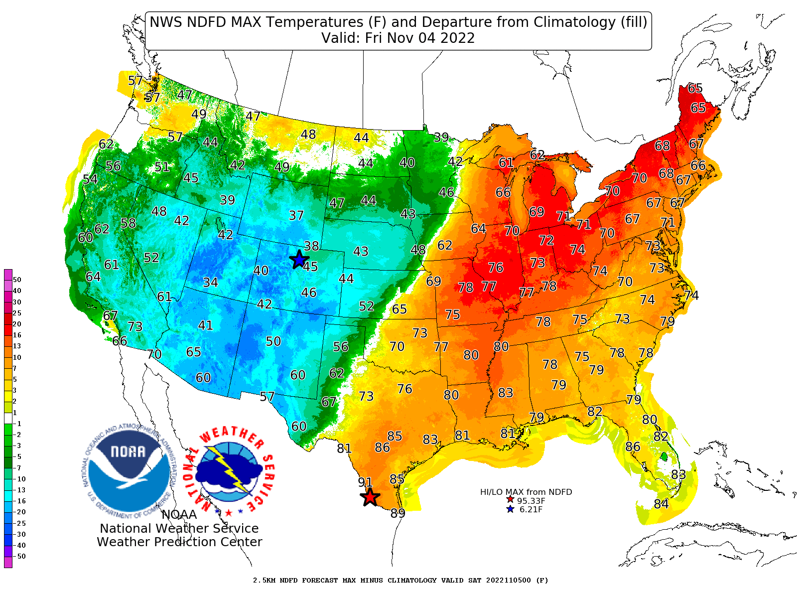
High temperature forecast and departures from average for Friday, November 2, 2022
A shortwave disturbance, now pushing into the Pacific Northwest, will amplify the western U.S. trough and result in the development of a strong surface low pressure system later this week. This feature will bring a plethora of weather impacts, including snow, flooding, and severe weather, to the U.S. this week and early weekend.
Impacts and timing
Snow has already developed across parts of the western Rockies and will continue increasing in coverage eastward tonight and tomorrow. Locations at higher elevations in Nevada, Utah, Wyoming, Colorado, Arizona, and New Mexico will exceed a foot of snow, with some localized spots of nearly two feet. Be sure to take plenty of pictures and send them to the snow-starved south!
The shortwave, and its developing surface low, will really start getting its act together in the Friday-Saturday timeframe. Rain, potentially heavy, and storms will develop Friday across parts of the central and southern Plains and move in an east or northeastward direction into the Mid-South and Midwest.
The greatest flooding risk will generally run in a south-north direction pretty much along and west of the Mississippi River. Some of that heavier rain will make it east of the Mississippi on Saturday, but as the low continues northeastward into the Great Lakes region, the storms will eventually just dissipate. The projected 3-day rainfall totals provide some insight into how far east the heavier amounts will occur and generally where the cut-off will occur.
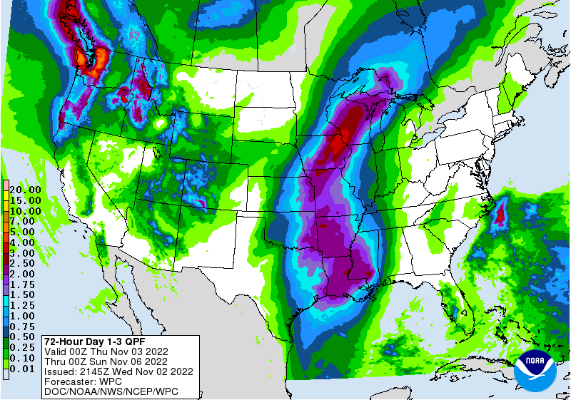
3-day rainfall forecast for Thursday-Saturday night
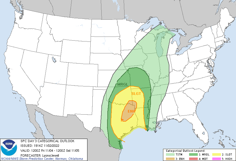
Severe weather probabilities for Friday into early Saturday
Summary
Again, the pattern will continue to favor below-average temperatures along and west of the Rockies and well above-average temperatures east of the Great Plains. The Plains and Midwest will alternate back and forth between well-above and below-average temperatures.
Head to the Rockies, Sierra Nevada, or the Cascades for snow, toward the middle of the country for flooding, severe weather, and crazy weather, or to the east and southeast for balmy and boring weather.