Heavy storms to bring flooding and damaging wind risk
Several rounds of severe weather will move along the periphery of high-pressure ridging in the coming days. A southeast ridge, along with an amplifying ridge building into the Northern Plains, has placed the Northern Plains, Midwest, Great Lakes region, Ohio Valley, and Mid-Atlantic in a favorable zone for severe storms.
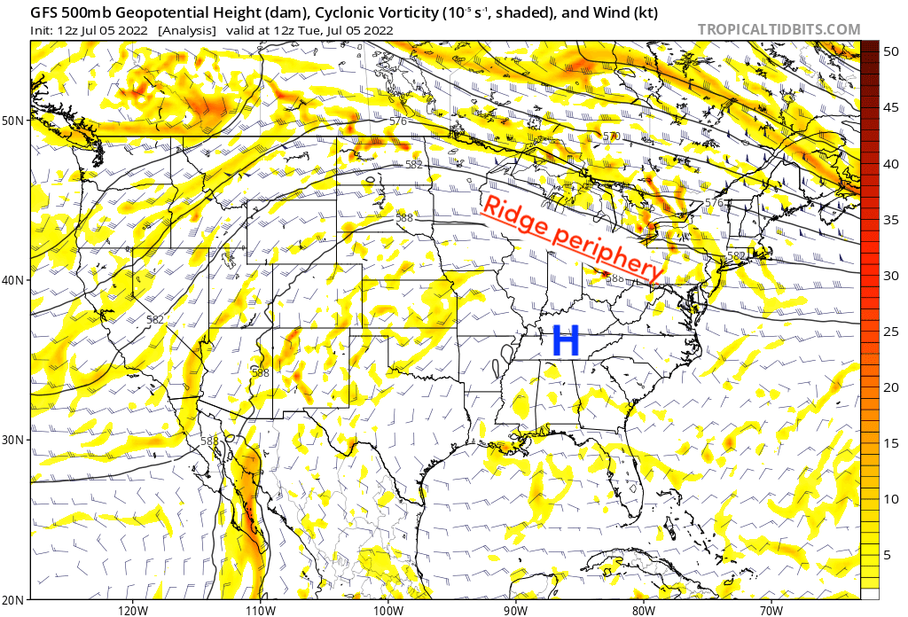
A cluster of severe storms has already developed across South Dakota, which will continue on a southeastward trajectory along the ridge periphery today into tonight. The Storm Prediction Center has a heightened severe risk across western portions of the Corn Belt, but severe storm chances extend all the way to the Mid-Atlantic region. The primary risk with this sort of setup is straight-line, damaging winds, heavy rain, and lots of lightning. If these storms remain organized long enough, it’s not out of the question that derecho criteria be reached. The current pattern certainly supports that possibility.
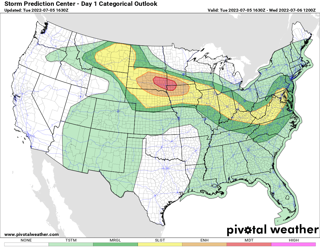
Today's severe weather risk – Jul 5, 2022
The Southeast ridge will retrograde westward into the Southern Plains on Wednesday and Thursday, as a trough digs over eastern Canada. This will result in a slight southern shift in the severe weather risk. Notice how the marginal and slight risk zones extend more to the Southeast and Mid-Atlantic regions on both days, even as far south as South Carolina and northern Georgia. Again, the primary risk will be damaging winds and heavy rainfall.
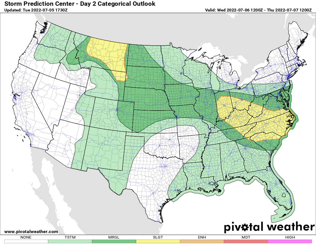
Tomorrow's severe weather risk – Jul 6, 2022
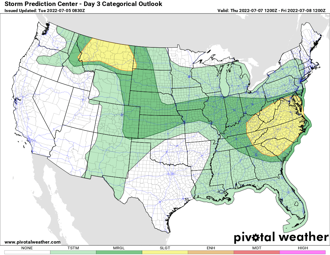
Thursday's severe weather risk – Jul 7, 2022
Looking at the expected rainfall totals over the next 5 days, we see that much of Texas/Oklahoma remains very dry, thanks to the retrograding ridge. Ridging won’t have as much of a stronghold over the Southeast, opening the door for the near-daily development of storms, especially later in the week. Then there’s the zone of heavier rainfall expected from the Corn Belt to the Mid-Atlantic/Carolinas this week, due to embedded disturbances moving along the ridge periphery as already discussed. So, heavier rainfall totals will be a bit more widespread across those regions, whereas the remainder of the Southeast and Florida will experience a more localized heavy rain risk.
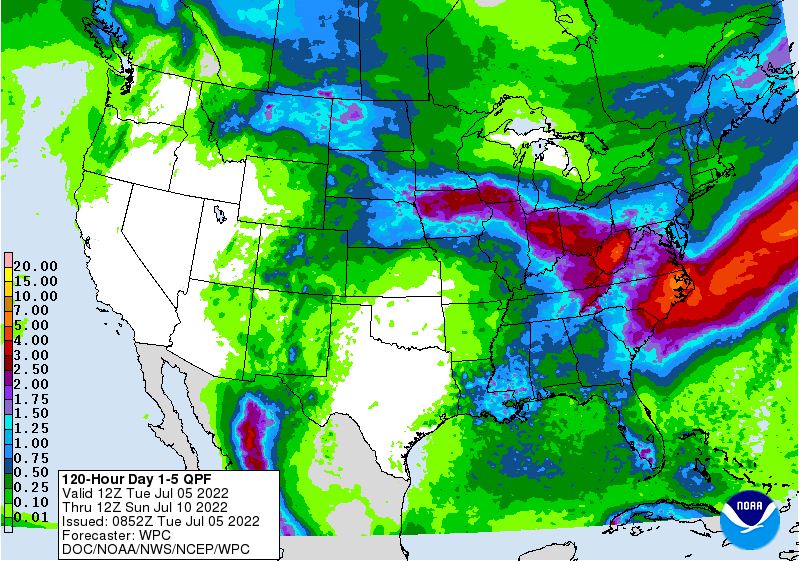
5-day rainfall forecast – Jul 5-10, 2022