Soaking Rains and Flooding Expected for Parts of the Southeast
A favorable pattern for numerous rounds of moderate to heavy rainfall will persist for at least several days across the lower Southeast and Florida. Ridging dominated the pattern earlier in the summer, which unfortunately favored anomalous heat and dry conditions. However, the last couple of weeks has brought a welcome change for many, with more widespread rainfall.
Prominent ridging will generally remain west of the region, while Bermuda ridging will tend to stay centered offshore. Anytime the Southeast finds itself positioned inside the weakness between two ridges, rain and storm chances are usually heightened for at least part of the time. The major downside is that this pattern provides no real protection from tropical cyclones impacting the region, but we’ll cross that bridge if we foresee this pattern persisting into August.
Despite recent rainfall, moderate to severe drought conditions still remain a concern for a decent chunk of the region. The current pattern will certainly help with that, but there’s usually a sort of hit-and-miss nature to storm activity in the summer, even when it’s expected to be more widespread. If we take a look at projected rainfall totals over the next 7-days, we see that the highest totals will likely occur closer to the Gulf Coast and Florida. Also, areas along the eastern Carolinas will have pretty high totals as well.
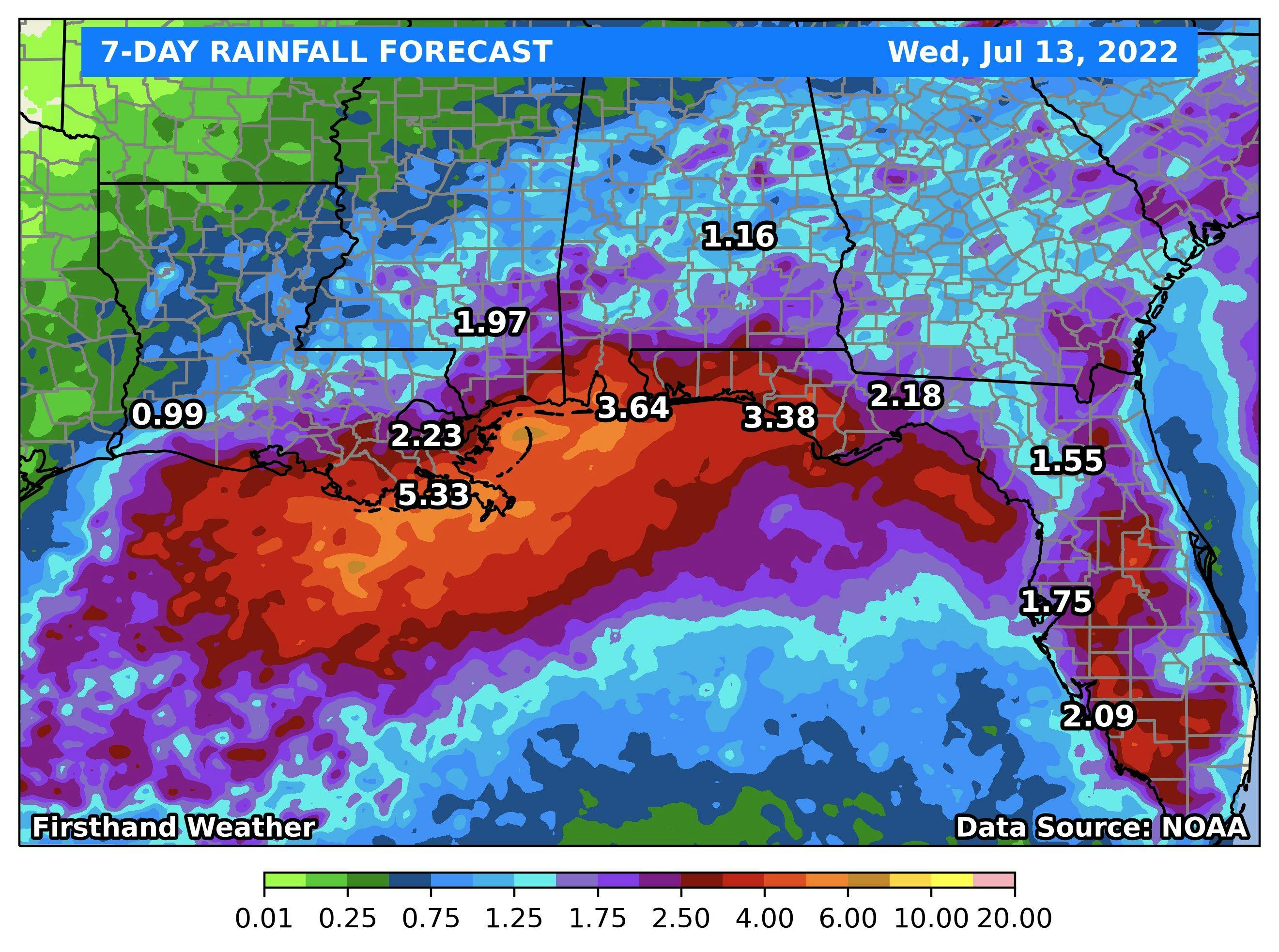
7-day rainfall forecast for Southeast and Florida: July 13-20, 2022
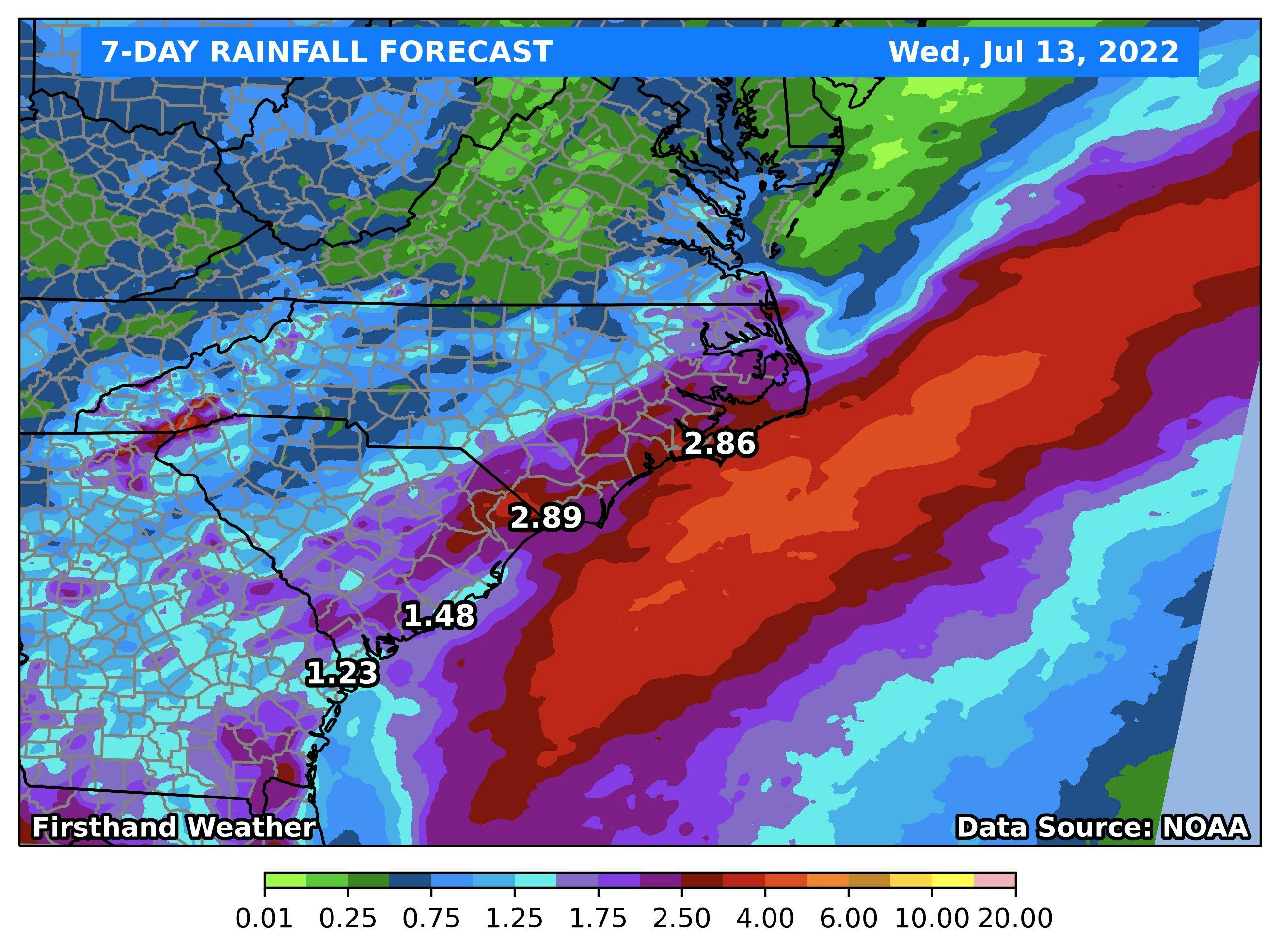
7-day rainfall forecast for Carolinas: July 13-20, 2022
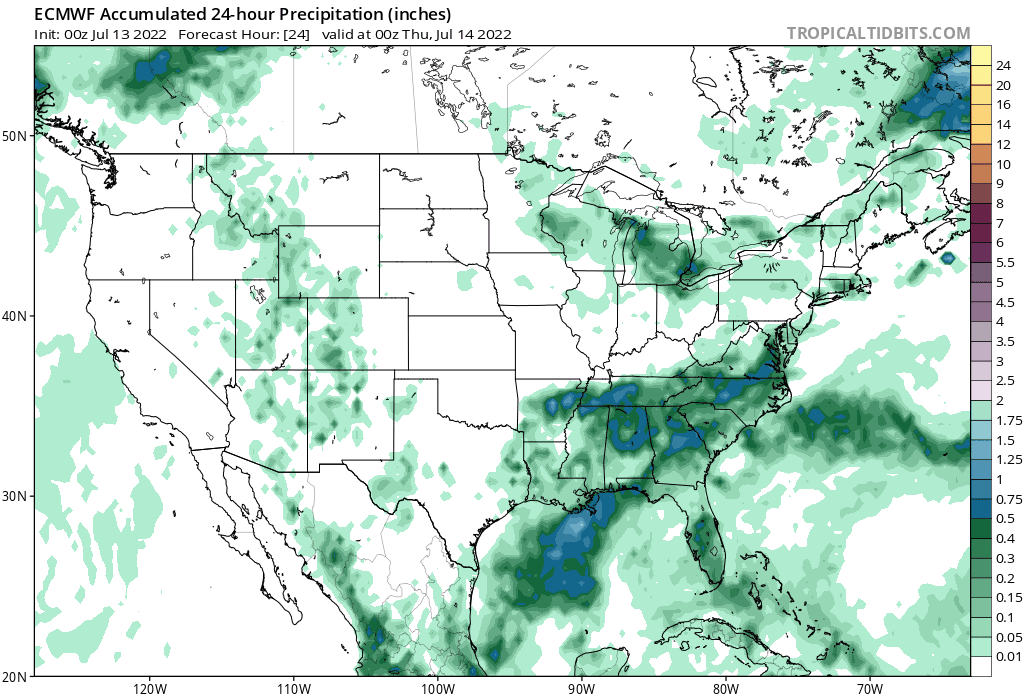
A frontal boundary will gradually sag southward this week before another front reinforces dry air behind it. This explains why Tennessee and the upper Gulf coast states, after today, will have drier and less humid weather, relative to the lower half of the Southeast. Taking a look at projected 24-h rainfall totals moving forward in time, we see that the heavier rainfall chances become more confined to the lower half of the Southeast and Florida this week along and south of the front.
To summarize, heavy rain and storm chances will persist across the lower half of the Southeast, and Florida into at least the weekend. A drying trend is to be expected across Tennessee and the northern Gulf Coast states after today behind the front. However, it shouldn’t be but a few days, at most, before humid and stormy conditions return to those areas.