Three Areas to Watch for Flooding Potential Thursday and Friday
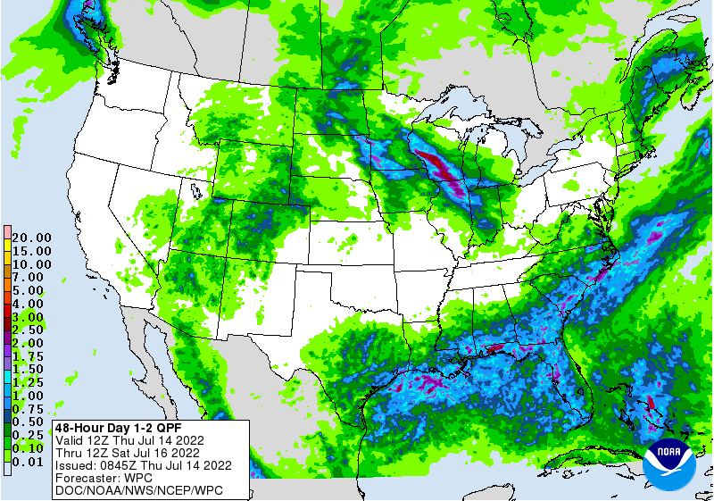
2-Day Rainfall Forecast: July 14-16, 2022
Across the Southeast, heavy storms will likely develop along and south of a slow-moving frontal boundary. The airmass along and near the Gulf and Southeast coasts is quite saturated. It won't take much lift in the atmosphere to generate storms capable of producing heavy rainfall and flooding. In fact, Montgomery, Alabama is already under a flash flood warning from heavy rains this morning.
Parts of the Four Corners region are under a flooding risk, due to monsoonal flow. Arizona and Utah are on the western periphery of the big ridge causing all of the hot weather in the central U.S. A large chunk of New Mexico has had the bulk of the heavy rain over the last 30 days, but we'll see the heaviest rainfall favor Arizona, Utah, western/northwestern New Mexico, and western Colorado this time.
A region stretching across parts of the Midwest and Northern Plains will have a risk of some flooding in places. A shortwave will rotate along the periphery of the big ridge and provide good chances of widespread rainfall today and tomorrow. Even beyond the next couple of days, we'll have to monitor any shortwave that moves along the ridge periphery for increased rain and storm chances.
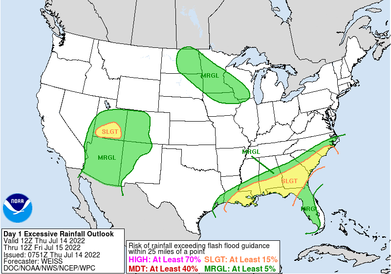
Flood Risk Forecast for July 14-15, 2022
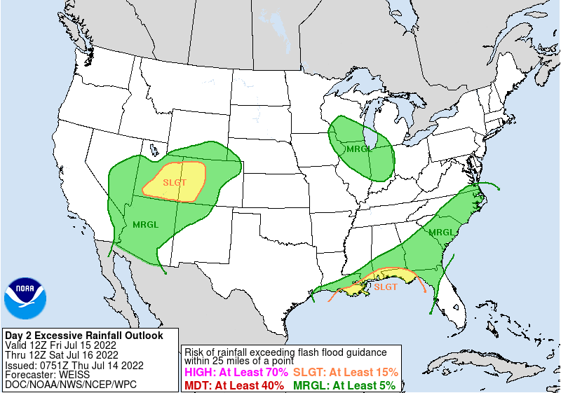
Flood Risk Forecast for July 15-16, 2022