Long-Duration Ice Storm Expected from Southern Plains (Dallas) to Mid-South (Little Rock) and Tennessee/Kentucky (Memphis)
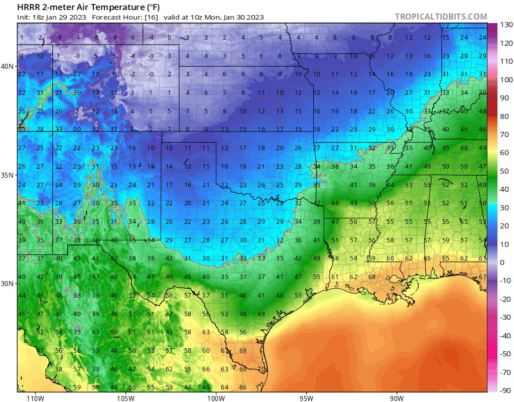
A strong Arctic cold front will continue pushing southeastward into the Southern Plains and Mid-South on Sunday and through early next week. Strong, high pressure will build behind the front, undercutting warmer air above the surface. Westerly to southwesterly flow aloft will keep an elevated warm nose established, while surface temperatures drop to or below freezing across parts of the Southern Plains, Mid-South and Tennessee/Kentucky.
Such a setup in the middle of winter often characterizes a long-duration period of freezing rain and/or sleet, usually orientened in a southwest-to-northeast direction. Furthermore, model guidance often underestimates the strength of the surface cold, usually resulting in icing occurring farther south and southeast. We can already see this when comparing short and medium-range models. Short-range guidance continues to trend farther southeastward with the freezing line across the Southern Plains and Mid-South.
Timing, Duration, and Ice Accumlations
A potent shortwave currently digging into southern California and Baja California will slowly move eastward this week. The slow movement of this feature will ensure several rounds of moderate to heavy precipitation move through the areas of interest between now and mid-to-late week.
Though icing will start Monday for quite a few, the more widespread precipiation will move through in the Tuesday-Thursday timeframe. The most significant icing risk will occur in the Tuesday to Wednesday timeframe. The freezing line will start pushing back northward on Thursday. So, some southern areas will likely transition back to rain on Thursday.
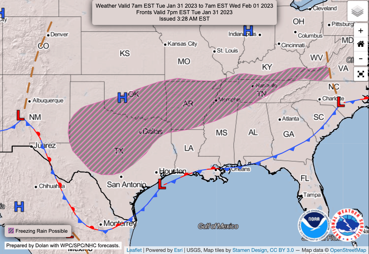
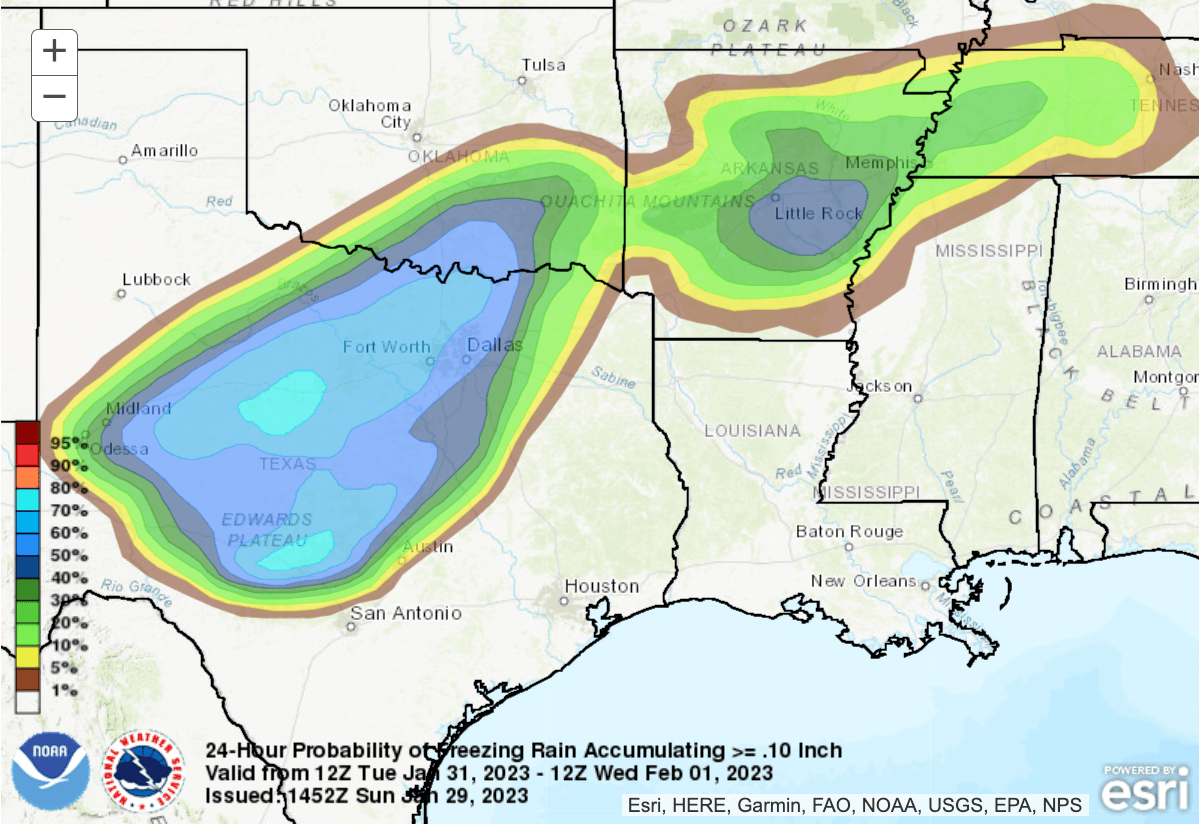
Honing in on the Tuesday morning to Wednesday morning timeframe specifically, a large swath of Texas, southern Oklahoma, Arkansas, and western Tennessee have decent probabilities of exceeding freezing rain accumulations of 0.10 inches. Those probabilities may need adjusting upward across western Tennessee, northern Mississippi, and southern parts of Kentucky. Glacing could occur as far south as northern Louisiana and north-central Mississippi.
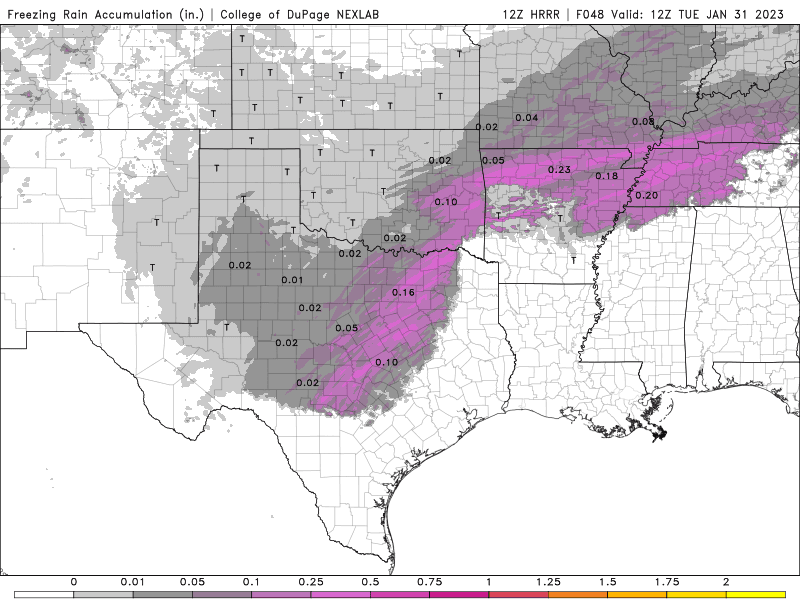
The 12z HRRR projects decent icing accumulations even by early Tuesday morning, before the main event.
Winter storm watches will probably start going out soon, before being updated to an advisory or warning. Winter weather advisories could also go out for areas surrounding the primary risk zone for ice glazing.
Please continue to monitor this icing event throughout the week. Uncertainies on the placement of the freezing line make this a challenging forecast.