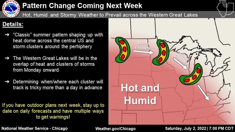
Omega Block Pattern To Support Hot and Stormy Weather This Week For Many
An omega block (a ridge sandwiched between two troughs) will persist across the lower 48 this week, mostly remaining centered across the heart of the nation. As a result, temperatures will stay quite hot across most of the Great Plains and the Midwest, while cooler temperatures will persist across the western U.S. and over New England.
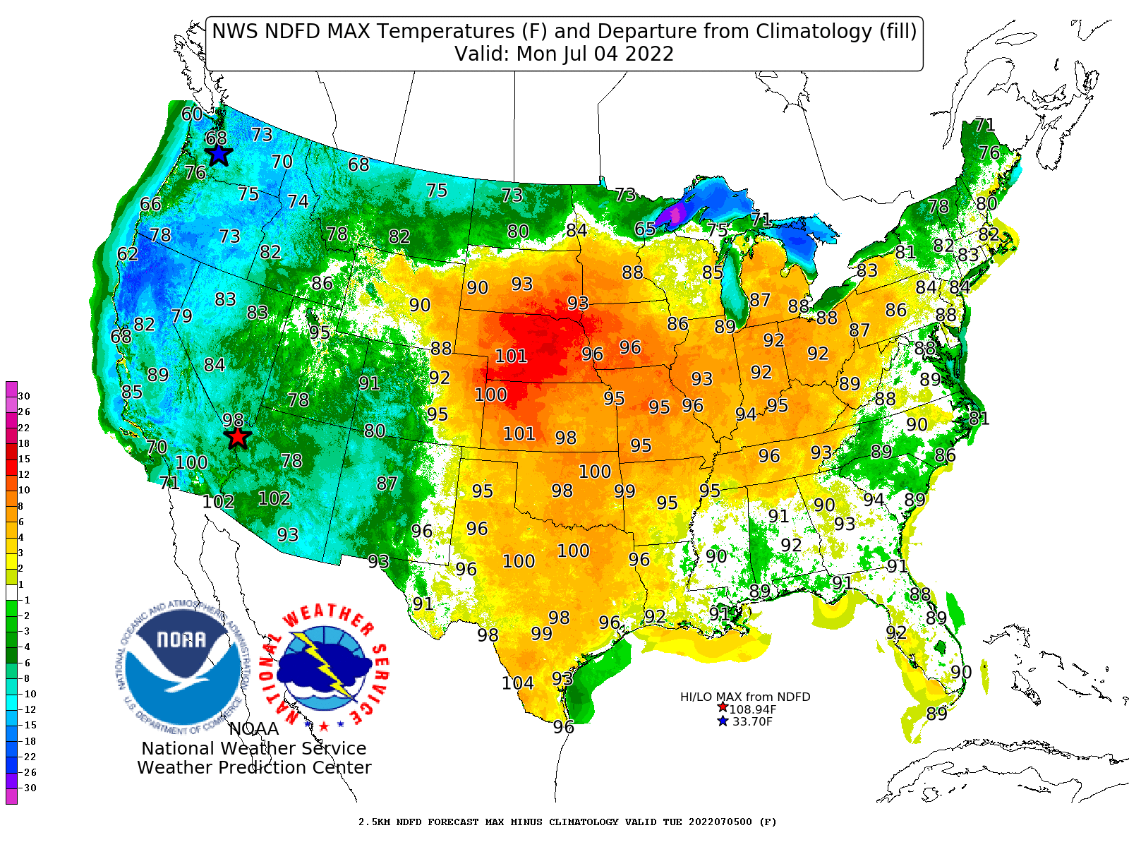
July 4, 2022 High Temperatures and Departures from Average
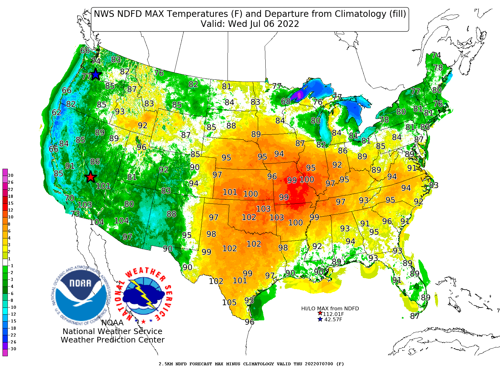
Wednesday, July 6, 2022 High Temperatures and Departures from Average
Texas and Oklahoma’s position underneath the ridge will keep both states mostly dry in the coming days. Disturbances will ride along the periphery of the omega block, bringing numerous days of stormy weather across the Northern Plains, upper Midwest, and Ohio Valley. In fact, any organized cluster of storms that develops poses a damaging wind risk.
Retrogradation of the ridge to the west will allow storm chances to stay in the forecast across much of the Southeast, especially across the Carolinas and along/near the Gulf coast. Temperatures will feel typical for summer in the region, but above-average moisture in the air will allow heat indices to reach uncomfortable levels this week.
New Mexico, eastern Arizona, and Colorado will remain in an active pattern for stormy weather throughout the week, thanks to their position to the west of the ridge. As the ridge builds westward later in the week, a warming trend will occur, not only in the Southwest but also across much of the Rockies.
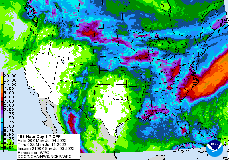
7-day rainfall forecast: July 4-11, 2022
You can get a detailed 7-day weather forecast right from our home page! We'll be improving this feature this week by adding icons and rainfall probabilities.